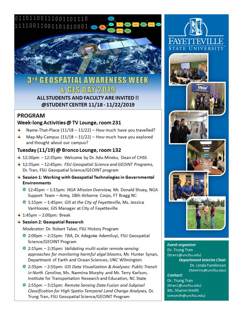
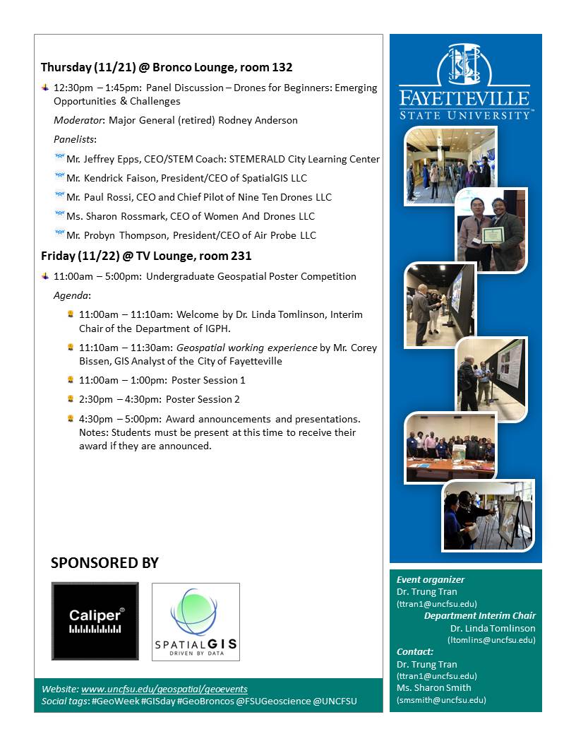
GeoWeek and GIS Day 2019
Geospatial Sciences B.A. | GEOINT certificate | Geospatial News | Geoscience Student Association
If you plan to participate in the FSU Undergraduate Geospatial Poster Competition with a poster presentation, please make sure that you read the guidelines as well as register for the presentation using the registration form below.
CALL FOR PARTICIPATION IN FSU UNDERGRADUATE
GEOSPATIAL POSTER COMPETITION
The Geospatial Science and GEOINT program in the Department of Intelligence Studies, Geospatial Science, Political Science, and History (Dept. ISGPH) at Fayetteville State University invites all FSU undergraduate students from all majors to present their geospatial research project that utilizes geospatial/map data in their quantatiative analyses (STEM) in the FSU Undergraduate Geospatial Poster Competition. Guidelines for the posters are below.
Who should attend this competition? All FSU undergraduate students from all majors.
Where to present your poster? The TV Lounge in the Rudolph Jones Student Center.
When to present your poster? The competitors must stand by their poster to present their poster to the judges at one of the two sessions on Friday (11/22/2019).
- Session 1: 11:00am - 1:00pm
- Session 2: 2:30pm - 4:30pm
What to present? Students should present any kind of research project that they have completed, which can be a class project that utilizes geospatial/map data in their quantatiative analyses (STEM). Please note that the reserearch project must be advised by an FSU faculty.
What is the size of the poster? The poster should be 36 x 48 in. Participants will attach their poster on a foam board placed on an easel in the student center. The foam board and easel will be lended by the Dept. ISGPH. Students must return the board and easel to the Dept. ISGPH when they are done by 5:00 pm on Friday (11/22).
How to participate?
Step 1: Register your poster abstract online in the form below by 11:59pm on Friday (11/15/2019).
Step 2: Make sure that you have your poster set up in the student lounge by 12:00pm on Friday (11/22/2019) for the judges.
Step 3: Be at your poster duirng either of the sessions listed above. You also should be present at 4:30pm - 5:00pm for the Award Ceremony in case you win the competition.
Comming soon.
The FSU 2018 GeoWeek and GIS Day is sponsored by Caliper Corporation and SpatialGIS LLC.
|
Caliper Corporation founded in 1983 and headquartered in Newton, MA, is a technology leader in the development of GIS and transportation software. Caliper is also a highly regarded consulting and R&D provider offering professional services in quantitative management consulting, transportation, and decision support systems development. Caliper software products are supported with extensive technical services in GIS applications and training, database development and software customization. Caliper is the developer of TransCAD® Transportation Planning Software, TransModeler® Traffic Simulation Software, and Maptitude® Mapping Software & Geographic Information System. |
 |
|
|
SpatialGIS is geospatial consulting firm founded by Kendrick O. Faison, M.S. GSci. Mr. Faison developed the company’s core services based around his more than 13 years of Geospatial and Emergency Management experience. SpatialGIS is a solution-focused company that specializes in supporting federal, state, local and commercial clients. SpatialGIS consolidates industry standards and develops a rapid geospatial team for all emergency situations along with agile development practices that gives us a competitive edge. |
 |


